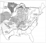
St. Louis Arm (Discarded)
Location
See text and Figure 5

References
Braile et al. 1982, 1984
Description
Interpretation of geophysical data led Braile et al. (1982, 1984) to propose a northwest branch of the Reelfoot Rift extending into Missouri. They labeled this branch the St. Louis Arm and postulated that the St. Louis Arm is one branch of a four-armed late Precambrian to early Cambrian rift system in the Mississippi Valley. The entire system has been called the New Madrid Rift Complex.
Evidence for the St. Louis Arm consists of northwest-southeast alignment of regional gravity and magnetic anomalies, as well as apparent northwest-trending zones of earthquake epicenters. One belt of epicenters more or less follows the Ste. Genevieve Fault Zone, which approximately bisects the purported rift arm. As shown by Braile et al. (1984), the St. Louis Arm is approximately 175 miles (275 km) long and 95 miles (150 km) wide. It covers all of the Sparta Shelf, the northeast flank of the Ozark Dome, and part of the western Fairfield Basin.
Geologic evidence disproves the existence of the St. Louis Arm. No rift-related sedimentary rocks or structures analogous to those of the Reelfoot Rift and Rough Creek Graben occur within the St. Louis Arm. Outcrops in the St. Francois Mountains and deep wells on the Sparta Shelf (fig. 4) all show Mt. Simon/Lamotte Sandstone and younger Upper Cambrian rocks of shelf fades in direct contact with granitic and rhyolitic Precambrian rocks. In contrast, the Reelfoot Rift and Rough Creek Graben both contain thick successions of layered rocks older than the Mt. Simon. Precambrian igneous rocks of the Ozark region are radiometrically dated as 1.4 to 1.6 billion years old, far older than the Reelfoot Rift. These rocks have been interpreted as being formed in a series of calderas and underlying stocks not in a rift (Kisvarsanyi 1981, 1984). Although many faults in the area trend northwest, they do not outline a graben and no pre-Devonian movement has been documented. Most of these faults are interpreted as products of differential uplift of basement blocks (Tikrity 1968, Gibbons 1972, Nelson and Lumm 1985, Clendenin et al. 1989). A COCORP seismic profile that crossed the area of the St. Louis Arm showed no crustal layering or evidence for a rift in Precambrian rocks (Pratt et al. 1989).
Braile et al. (1982, 1984) suggested that absence of graben fill sediment in the St. Louis Arm is a result of uplift in the region. This would require major uplift and erosion during Middle Cambrian time before deposition of the Mt. Simon/Lamotte Sandstone. Even if this had occurred, the graben-bounding faults would be preserved. Braile et al. (1982, 1984) alternatively proposed that rifting in the St. Louis Arm never attained the stage of graben formation, but dense rock was intruded into the lower crust, accounting for the geophysical anomalies. Another possibility is that geophysical trends reflect features of Precambrian rocks much older than the Reelfoot Rift. Geophysical and structural trends from the northwest are evident not only within the St. Louis Arm, but also in most of the rest of Missouri, western Illinois, and large areas of neighboring states. In conclusion, the St. Louis Arm does not exist and the name should not be used.
See also REELFOOT RIFT, ROUGH CREEK GRABEN, SOUTHERN INDIANA ARM (discarded).

