New Burnside Anticline
Location
From T11S, R3E, Johnson County, to T10S, R6E, Saline County (J-6 and pl. 2)
References
Brokaw 1917, J. Weller 1940, Stonehouse and Wilson 1955, Heyl et al. 1965, Jacobson and Trask 1983, Nelson 1987a, Nelson et al. 1991
Description
The New Burnside Anticline, as originally defined by Brokaw (1917), lies in northeastern Johnson County. J. Weller (1940) defined the Stonefort Anticline in Pope County. Recent mapping (Nelson et al. 1991) demonstrates that the New Burnside Anticline connects eastward with the Stonefort Anticline. A single name, rather than two or more separate names, should be applied to this continuous structural feature. Because the name New Burnside has priority, the term New Burnside Anticline is applied to the entire feature, and the name Stonefort Anticline is discarded.
The New Burnside Anticline lies northwest of and trends parallel to the McCormick Anticline. The New Burnside and McCormick structures are similar in geometry, although the New Burnside has gentler dips and less relief. The New Burnside Anticline has as much as 200 feet (60 m) of structural relief in Saline County and possibly more than 300 feet (90 m) in northeastern Johnson County. The fold is asymmetrical; the northwest limb is steeper than the southeast flank and has greater relief. Strata on the northwest limb commonly dip 15° to 25°, but dips greater than 5° are unusual on the southeast flank except next to faults.
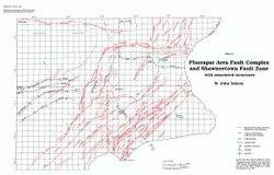
A broad saddle separates the previously named Stonefort and New Burnside Anticlines about 1 mile (1.6 km) east of the common corner of Johnson, Pope, Saline, and Williamson Counties. In the saddle a railroad cut along the Illinois Central Railroad shows the structure to be a monocline that has local flexures and small normal faults on the north-dipping flank. Discontinuous faults occur along the anticline and extend beyond both ends. High-angle normal faults, striking to the northeast, predominate (fig. 55). In Saline County, they splay outward to the northeast and are en echelon to the fold axis. In central Johnson County where the anticline dies out, the faults curve southward, as do those of the McCormick Anticline.
A proprietary seismic reflection profile suggests that the New Burnside Anticline, like the McCormick Anticline, is a thin-skinned anticline detached from basement. Ordovician and younger reflectors are folded on the seismic profile and older ones are not. Thrust faults that flatten downward are also indicated on both anticlines. Compressional stress that caused folding may have been transmitted northwest from the Lusk Creek Fault Zone along one or more décollements (fig. 50).
The association of an anticlinal fold (compressional) and subparallel normal faulting (extensional) points to two different stress fields and periods of deformation. Comparison with the McCormick, Lusk Creek, and Shawneetown structures suggests that an early phase of compression was followed by later extension. The movements were largely, if not entirely, post-Pennsylvanian.
See also McCORMICK ANTICLINE.
References
Figure(s)
|


