Level Hill Fault
From ILSTRUC
Part of the Rough Creek-Shawneetown Fault System
Location
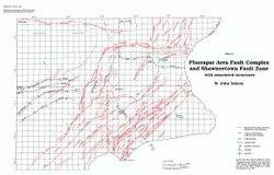
Southern T9S, R8E, Gallatin County (pl. 2)

References
Nelson and Lumm 1987
Description
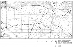
This fault, mapped from outcrops, is a few hundred yards south of and strikes parallel with the front fault of the Rough Creek-Shawneetown Fault System. It joins the front fault at its western end; it may connect with the Ringold Fault eastward. Numerous perpendicular and diagonal cross faults connect the Level Hill and front fault, and they outline tilted upthrown and downthrown slices.

