La Salle Anticlinorium (New Name)
Old Name: La Salle Anticlinal Belt
Location
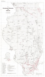
From Lee to Lawrence Counties, Illinois (fig. 1)

References
(selected) Freeman 1868, Blatchley 1910, 1912, 1913, Cady 1920, Payne 1939, Willman and Payne 1942, Clark and Royds 1948, Green 1957, Clegg 1959, 1965a, 1970, McGinnis and Heigold 1961, Atherton 1971, Buschbach and Bond 1974, McGinnis et al. 1976, Steams 1978, Kolata and Graese 1983, Suppe and Medwedeff 1984, Jacobson 1985, Lowell 1985, Treworgy and Whitaker 1990a, b, Reed et al. 1991, Treworgy et al. 1994
Description
The name La Salle Anticlinorium is introduced for the feature that has been called La Salle Anticlinal Belt in most recent reports. The La Salle structure neatly fits the definition of an anticlinorium, as given in the Glossary of Geology (Gary et al. 1972): "A composite anticlinal structure of regional extent, composed of lesser folds." The term "anticlinorium" is more widely used in the geologic literature than is the term "anticlinal belt." Changing the name from anticlinal belt to anticlinorium also avoids the possible implication that the La Salle is a fold-thrust belt comparable to the Ouachita or Allegheny fold-thrust belts.
The La Salle Anticlinorium first became known from outcrops along the Illinois River in La Salle County (fig. 45). Subsequent drilling for oil and gas extended knowledge of the structure southward through the subsurface. Tens of thousands of wells have been drilled and approximately 750 million barrels of oil produced from reservoirs along the La Salle Anticlinorium. In spite of considerable economic interest, the deeper structure remains unknown. Little has been published concerning structural style, geophysical character, origin, and tectonic evolution of the La Salle.
The anticlinorium has subparallel anticlines, domes, monoclines, and synclines, several dozen of which are individually named. The pattern frequently is described as en echelon, but this term is misleading. In a true en echelon fold belt, the individual structures are aligned at an angle to the overall trend of the system. Such a pattern commonly reflects strike-slip deformation, as is illustrated by the en echelon anticlines and subsidiary faults in the Cottage Grove Fault System. The La Salle Anticlinorium, in contrast, consists of folds that are oriented mainly parallel to the north-northwest strike of the larger structure. Individual folds are offset from one another and partially overlap. Northward, the individual folds generally step off toward the west.
The anticlinorium also exhibits a branching pattern, which is better shown on a structure contour map such as the one on the Galena Group (Bristol and Buschbach 1973), than it is on plate 1. From southern Lawrence through Crawford and Clark Counties, a single slightly misaligned row of elongated domes and anticlines occurs on top of a west-dipping monocline, newly named the Charleston Monocline. The structure splits in northwestern Clark County. One arm continues northward as the Edgar Monocline, whereas the Charleston Monocline continues northwestward to the west side of the Tuscola Anticline. Another split takes place in eastern Piatt County, where the Osman Monocline trends northward and the Downs Anticline is offset toward the west (plate 1). The Osman Monocline extends through Ford County and approximately lines up with unnamed anticlines farther north, which in turn line up with the Herscher Anticline in Kankakee County. The Downs Anticline terminates in northern McLean County. The Peru Monocline (new name) arises east of the Downs Anticline and extends northwestward to the northern terminus of the anticlinorium in Lee County.
Strong asymmetry marks the La Salle Anticlinorium. The major folds are monoclines topped by irregular domes and anticlines. Along most of the trend, the steeper dip and greater structural relief is toward the west into the Fairfield Basin. The folds in northern Edgar County have steep eastern limbs, but the relief is much less than on the western limb of the Tuscola Anticline to the west. Some smaller elements also deviate from the overall trend. For example, the Ancona Anticline (C, D-6) has a steep northeast flank, and some folds in Lawrence and Crawford Counties are steepest on the southwest limb.
The principal uplift of the La Salle Anticlinorium took place late in the Paleozoic Era. Clegg (1965a, 1970) documented that approximately half of the overall uplift occurred after Chesterian and before Pennsylvanian sedimentation. As a result, an angular unconformity is found beneath Pennsylvanian strata through the length of the structure. The time represented by missing strata increases northward to La Salle County, where Pennsylvanian strata overlie rocks as old as the St. Peter Sandstone (Ordovician) on the crest of the fold. Thinning of various beds and intervals in the middle Pennsylvanian demonstrates that uplifts continued gradually through this time Jacobson 1985). Major folding resumed after the Pennsylvanian Period. Some authors have suggested pre-Mississippian activity in the La Salle Anticlinorium, but such effects are slight compared with Mississippian and later movements. For example, Kolata and Graese (1983) found moderate thinning of the Upper Ordovician Maquoketa Group across the Peru Monocline in La Salle County.
Drilling for gas storage fields at several places along the La Salle Anticlinorium produced data showing that folds on the basal Cambrian Mt. Simon Sandstone are similar in location, shape, and magnitude to folds on younger pre-Pennsylvanian horizons (Buschbach and Bond 1974). Seismic profiles confirm that the entire sedimentary column is folded and the amount of structural relief does not change appreciably with depth. Figure 23 is a seismic profile across the Charleston Monocline a few miles north of Charleston, Coles County. The fold axis is essentially vertical and the lower hinge is sharp, whereas the upper hinge is a smooth curve.
Faulting has been documented in several places along the La Salle Anticlinorium. Proprietary seismic reflection profiles (interpreted in 1992 by P.C. Heigold, ISGS) reveal faulting at depth along the southern part of the anticlinorium. Specifically, high-angle reverse faults are present on the west flank of the Lawrenceville Dome, the east flank of the Bridgeport Anticline, and the southwest flank of the Hardinville Anticline. These faults displace reflectors correlative with the top of Precambrian basement and Cambrian strata and die out at or below the base of the Knox Group. Displacement of the basement surface on the east flank of the Bridgeport Anticline is estimated to be about 500 feet (150 m); the largest fault on the Hardinville Anticline may have 300 to 400 feet of throw (90-120 m). These seismic profiles did not cross the Charleston Monocline, which has considerably greater relief than the structures that were profiled.
Elsewhere, several east-west faults mapped on the Troy Grove Dome in La Salle County were based on borehole data on the Mt. Simon Sandstone (Cambrian). These faults outline a graben perpendicular to the steep west flank of the dome (Buschbach and Bond 197 4). In eastern Coles County, borehole records indicate faulting in Mississippian strata near the west flank of the Ashmore Dome. A missing section in one well indicated 250 feet (75 m) of displacement (Reed et al. 1991). The orientations of these faults are unknown.
The La Salle Anticlinorium evidently is the product of Late Paleozoic displacements on faults in crystalline basement. Most, if not all, of the basement faults die out upward through sedimentary cover. Thus, faults in the La Salle could be classified as drape folds (Steams 1978) or fault-propagation folds (Suppe and Medwedeff 1984); and the La Salle is very similar in structural style to monoclines produced during the Laramide orogeny in the western United States (Lowell 1985, chapter 3). The complex arrangement of folds in the La Salle Anticlinorium suggests a mosaic of faults in the basement of eastern Illinois.


