Peters Creek Fault Zone
Part of the Fluorspar Area Fault Complex
Location
Eastern Hardin County (pl. 2)

References
S. Weller et al. 1920, Hubbert 1944, Grogan 1949, J. Weller et al. 1952, Brown et al. 1954, Heyl and Brock 1961, Baxter et al. 1963, Brecke 1964, Baxter and Desborough 1965, Heyl et al. 1965
Description
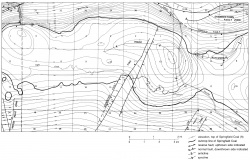
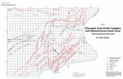
The Peters Creek Fault is a northeast-trending fracture zone that forms part of the southeast side of the Rock Creek Graben in Illinois. It has been called a fault system but the correct term is a fault zone. To the northeast it apparently is a single fault; southwestward, it divides into numerous subparallel branches. The overall displacement is down to the northwest and approaches 1,000 feet (300 m) in places. Palmer (1976) mapped a possible northeastern extension of the Peters Creek Fault Zone into Kentucky.

