File:B100 figure 62.jpg
From ILSTRUC
Size of this preview: 359 × 599 pixels. Other resolution: 1,289 × 2,150 pixels.
Original file (1,289 × 2,150 pixels, file size: 451 KB, MIME type: image/jpeg)
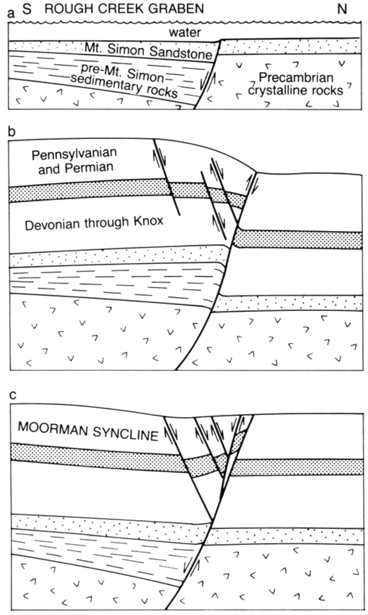
Figure 62 Development of the Rough Creek-Shawneetown Fault System. (a) During deposition of the Mt. Simon Sandstone (Late Cambriam)-normal faulting, down to the south; the Rough Creek Graben is south of the fault system. (b) Late Paleozoic - reverse faulting, down to north. (c) Early Mesozoic - normal faulting, down to the south. Slivers sheared off the hanging wall; the Moorman Syncline developed south of the fault system.
File history
Click on a date/time to view the file as it appeared at that time.
| Date/Time | Thumbnail | Dimensions | User | Comment | |
|---|---|---|---|---|---|
| current | 15:20, 11 July 2019 | | 1,289 × 2,150 (451 KB) | Alan (talk | contribs) |
You cannot overwrite this file.
File usage
The following page uses this file: