Daisy Fault
Part of the Fluorspar Area Fault Complex
Location
Sections 29 and 32, T12S, R8E, Hardin County (pl. 2)

References
S. Weller et al. 1920, Bastin 1931, Hubbert 1944, J. Weller et al. 1952, Baxter and Desborough 1965
Description
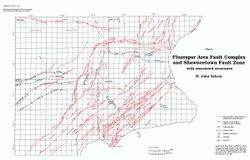
The Daisy Fault was named for the Daisy fluorspar vein, which in turn took its name from the abandoned Daisy Mine. The fault and vein are part of a complex system of fractures along the southeast margin of the Rock Creek Graben. The Daisy Fault strikes N20°E, dips 70° to 80°W, and has as much as 350 feet (106 m) of normal displacement. Bastin (1931) reported that slickensides on the fault plane varied in plunge from 10°S to 80° , indicating a component of strike-slip. He also stated that the western or hanging wall of the vein is a postrnineralization fault plane, whereas the ore is "frozen" to the east wall.
